(From BMDSF Draft Management Plan 2008)
BMDSF was within the territory of one or more of the following Native American groups: the Eastern Pomo, Southeastern Pomo, Lake Miwok, Clear Lake Wappo, and Patwin. Since the crest of Boggs Mountain divides the Putah and Kelsey Creek watersheds and since California Native Americans often used watershed divides as territory boundaries, it is likely that more than one group controlled the area. Evidence shows that Boggs Mountain enjoyed some prehistoric use year-round with populations rising during the summer and fall months.
Artifacts collected on BMDSF support the theory that the primary pre-historic activity on Boggs Mountain was hunting. No known milling equipment has been found within the forest boundary. Archaeological research in the State Forest has revealed temporary camps, collecting stations, lithic workshops, and chipping stations. Also, a high projectile point to debitage ratio is found throughout the forest. Neither informal flaked stone tools nor any nonflaked expedient tools are present in the BMDSF collection.
The majority of prehistoric archaeological sites and artifacts discovered on BMDSF belong to the Late Prehistoric Period (A.D. 500-1579) which appears to be the largest population density of indigenous people. This large population continued through the Proto-historic period, until the time of initial contact between the California Native Americans and the Europeans.
During the Mexican period, trappers including Jedediah Smith and Ewing Young explored Clear Lake or its tributaries in the early 1830’s. These visits were of little consequence on the Clear Lake Basin until Mariano Vallejo was granted 44,280 acres in June 1834. The first Mexican military penetration into Clear Lake country and what is now Boggs Mountain Demonstration State Forest occurred during fights with the Wappo in 1835. When the Californios Cavalry killed over 200 attackers, Governor Figueroa forced a peace. The following April, in 1836, a second attack by 20 Californios and 100 Suisun Indians against the Wappo resulted in a peace treaty where 7 local chiefs agreed to live in peace. As a result of this treaty, Mariano’s brother, Salvador Vallejo received a 71,000 acre land grant including Boggs Mountain Demonstration State Forest area.
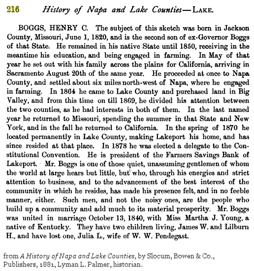
With statehood in 1850, California became the 31st state in the Union and Napa became one of the original 27 California counties. Lilburn W. Boggs, ex-Governor of Missouri, and a successful merchant in Sonoma farmed the Napa Valley. Sometime before 1860 he purchased land in what is now Lake County. Boggs’ son Henry C. bought a steam-powered sawmill in 1866 and later combined sawmill, gristmill, and planer. Located on the eastern margin of what is now Boggs Mountain Demonstration State Forest, Boggs’ Mill and Boggs’ Lake operated until 1880. In 1878 Henry C. Boggs bought a small lot near the head of Malo Creek, moving his sawmill there two years later. By 1884 Henry Boggs bought almost all the timberland within the present State Forest boundaries. His son Lilburn H. Boggs served as manager in addition to his duties as Lake County Sheriff. The major road between Middletown and Clear Lake, now Highway 175, was called Boggs’ Road in the early 1880’s. Logging took place on most of what is now the State Forest, with the heaviest cutting between 1882 and 1887. By 1898, the year of Henry C. Boggs death, the Farmers Savings Bank under its president James W. Boggs, had acquired just about all the acreage presently incorporated by the State Forest.
The property was subsequently owned by Hugh Davey then Jim McCauley. McCauley
established a resort near the head of Kelsey Creek renaming it Camp Calso. Jim McCauley died in 1941 and his heirs sold the timber rights to Setzer Forest Products. Most of the land use after Boggs was for cattle-grazing until 1947 when the then present owner, Calso Company, sold the timber rights on 2700 acres to the Setzer Forest Products Company. The funds to purchase lands for State Forests were made available by the 1947 legislature to implement the State Forest Purchase Act (PRC 4631).
In December 1949, after Setzer had clearcut 2800+ acres, the State of California bought the timberland for $38,700 with the intention of creating a demonstration forest. The research concern at Boggs Mountain Demonstration State Forest was the study of forest recovery from a completely cut over area. 3,432 acres of land and timber were acquired from the Calso Company for $20,600. The remaining $18,100 went to Setzer Forest Products Company. Setzer owned the merchantable timber on 2,731 acres of the tract. Setzer sold all the timber between 16 and 23 inches in diameter at breast height (DBH) (an estimated 6,100,000 board feet of timber) and one million board feet of thrifty seed trees between 23 and 29 inches DBH to the State for under terms of a precutting agreement. All other commercial timber was harvested in 1949 and 1950.
Setzer completed logging their timber holdings in 1950. In 1954, Glenco Forest Products Company, successor in interest to Setzer Forest Products, quitclaimed its rights, title, and interest in the property to the State in accordance with the terms of the cutting agreement.
The status of the Forest at the time of purchase by the State was that of a recently cut-over forest from which all merchantable timber had been harvested except for scattered seed trees and patches of old-growth trees considered inaccessible at the time of purchase. Early State occupancy of the Forest property was mainly for protective and custodial purposes. The Service Forester assigned to the Region I Office in Santa Rosa did inventory and mapping, to a limited extent, during this period.
In 1965, Cliff Fago, became the first permanent forest manager assigned to Boggs Mountain State Forest. He completed the forest inventory, began experimental and demonstrational activity, and conducted the first timber sale in 1966. The timber harvesting was directed toward removal of the remaining old growth. The residual old growth was essentially removed from the Forest by 1976, and since then, cutting methods have been used that will result in a regulated, all-age forest. An active experimental and demonstrational program has developed during this period involving growth determination, disease control, better utilization methods, fertilization studies, and reforestation.
Geothermal activity, particularly in the Cobb Mountain area, a few miles west of Boggs Mountain, caused an increase in the surrounding population in the 1980’s. Exploratory drilling occurred in the surrounding areas, including Boggs Mountain Demonstration State Forest, where Geothermal Kinetics, Inc. made an exploratory drilling to a depth of approximately 4,400 feet in July 1981. The drilling was abandoned, however, when geologic conditions indicated that a geothermal source would not be found at a depth that would make utilization feasible.
No timber was cut on the Forest from the completion of logging in 1950 until 1967 when
3,085,000 board feet of old growth was cut. A Forest-wide inventory was completed the same year which estimated the total gross timber volume after the 1967 cut at 31,465,000 board feet on 3433 acres, 6,000,000 or more of which was old growth. The acquisition estimate apparently considerably under estimated the merchantable volume on the Forest. Most of the residual old growth was harvested from the Forest by 1976.
Total area of the Forest at present is 3493 acres. Two land purchases have added to the forest land base. Thirty-one (31) acres were added to the Forest in 1972, when the Division of Forestry acquired Lot 3, Sec. 6, T11N, R7W from the State Lands Commission for $5600. A 40+-acre parcel in the NW1/2SE 1/4, Sec. 35, T11N, R8W was purchased from the Voss family by the State of California in 1991. A portion of the Forest was sold in 1981, as a result of Assembly Bill 476. 9.8 acres in SE1/, SE1/4 Sec. 3, T11N, R8W were sold to the Middletown Unified School District for $41,160.
“Sketch” of Henry C. Boggs: